Geomatics Engineer
Geomatics engineers gather, model, analyze, and manage information that is identified according to its location (spatially referenced data).


There was an error. Please try again.
This page is already listed in your guide. Please choose a different page to add.
Geodetic Engineer, Geoinformatics Engineer, Geographic Information Systems (GIS) Engineer, Geospatial Engineer, Photogrammetric and Remote Sensing Engineer, Professional Engineer, Remote Sensing Engineer, Surveying Engineer
In Canada, the federal government groups and organizes occupations based on a National Occupational Classification (NOC) system. This alis occupation may not reflect the entire NOC group it is part of. Data for the NOC group can apply across multiple occupations.
The NOC system is updated every 5 years to reflect changes in the labour market. Government forms and labour market data may group and refer to an occupation differently, depending on the system used.
Here is how this occupation has been classified over time.
2006 NOC
2006 NOC-S
2011 NOC
2016 NOC
2021 NOC
2023 OaSIS
Geomatics engineers use sensors on the ground, in the ocean, in the air, and on satellites to gather data. They use this data to develop information systems. These systems are suitable for land use planning and landscape analysis. For example, they may acquire and integrate data for:
Geomatics engineers use measurement-related technologies such as:
The data collected is made available through various means. These can include digital data repositories, conventional maps, GIS, or attributed coordinate lists.
Geomatics engineers may specialize in several different areas. For example:
Geodetic engineers are global surveyors who help to:
Land surveyors plan, direct, and carry out legal surveys. They find the location of boundaries, contours, and other natural or human-made features and interpret them into the survey. To learn more, see the Land Surveyor occupational profile.
Navigation and positioning engineers:
Photogrammetric and remote sensing engineers:
Geographic information systems engineers:
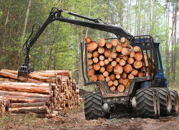
Geomatics engineers may work in offices and labs. They may also work in the field, often in remote areas. In general, survey technicians do the fieldwork for land surveyors. Experienced engineers tend to spend more time in office settings.
Fieldwork may involve operating off-road vehicles. It can also mean working in severe weather conditions. Engineers may have to lift and carry equipment weighing up to 20 kilograms.
In Alberta, this occupation is part of 1 or more 2023 National Occupational Classification (NOC) groups. If there are multiple related NOC groups, select a NOC heading to learn about each one.
Many NOC groups include 1 or more related occupations. The labour market data shown is for the whole group, not for a specific occupation. For examples, see Note.
To find out how well this occupation fits your work personality types, complete the Work Personalities Quiz in Find Your Fit.
Click or tap a personality type for its description.
Find other alis occupations that match this occupation’s work personalities.
To identify or change your work personalities, complete the Work Personalities Quiz in Find Your Fit.
In Alberta, this occupation is part of 1 or more 2023 National Occupational Classification (NOC) groups. If there are multiple related NOC groups, select a NOC heading to learn about each one.
Many NOC groups include 1 or more related occupations. The labour market data shown is for the whole group, not for a specific occupation. For examples, see Note.
Civil engineers
2023 OaSIS: 21300.00
The graph below shows how well your scores match the overall abilities for this occupation.
The closer your ability scores are to the center, the more they match this occupation’s. The further away they are, the less they match this occupation’s.
The lower your ability scores are compared to the occupation’s, the more challenging the occupation will likely be for you. The higher your ability scores are compared to the occupation’s, the less challenging the occupation will likely be for you.
To find out how well this occupation fits your abilities, complete the Abilities Quiz in Find Your Fit.
The 49 abilities are grouped into 5 abilities sets: Critical Thinking, Numbers and Patterns, Physical Activity, Mind-Body Coordination, and Senses.
Some abilities are more relevant to an occupation than other abilities. Individual abilities that are not relevant to an occupation are greyed out.
To fill in or change the values for your abilities, complete the Abilities Quiz in Find Your Fit.
Critical Thinking includes 9 abilities related to identifying and solving problems, thinking of ideas, and communication, such as speaking and writing.
This is how well your scores match the set of Critical Thinking abilities for this occupation:
Numbers and Patterns includes 10 abilities related to math, memorizing, and multitasking. It also includes how we perceive patterns, shapes, and distances.
This is how well your scores match the set of Numbers and Patterns abilities for this occupation:
Physical Activity includes 9 abilities related to strength, balance, flexibility, coordination, and endurance.
This is how well your scores match the set of Physical Activity abilities for this occupation:
Mind-Body Coordination includes 9 abilities related to movement control and how we react to signals. It also includes fine motor skills, such finger and hand dexterity and hand-eye coordination.
This is how well your scores match the set of Mind-Body Coordination abilities for this occupation:
Senses includes 12 abilities related to seeing, hearing, and speaking.
This is how well your scores match the set of Senses abilities for this occupation:
Geomatics engineers need:
They should enjoy:
In Alberta, this occupation is part of 1 or more 2016 National Occupational Classification (NOC) groups. If there are multiple related NOC groups, select a NOC heading to learn about each one.
Many NOC groups include 1 or more related occupations. The labour market data shown is for the whole group, not for a specific occupation. For examples, see Note.
This chart shows which job skills are currently in highest demand for this occupational group. It was created using this occupation's 100 most recent Alberta job postings, collected between Feb 11, 2023 and Jul 15, 2026.
Review these skills to learn:
| Tasks: Evaluate and recommend appropriate building and construction materials | 65 |
|---|---|
| Tasks: Interpret, review and approve survey and civil design work | 65 |
| Tasks: Confer with clients and other members of the engineering team and conduct research to determine project requirements | 59 |
| Construction Specialization: Organized | 57 |
| Tasks: Develop construction specifications and procedures | 55 |
| Tasks: Conduct field services for civil works | 55 |
| Construction Specialization: Accurate | 52 |
| Tasks: Ensure construction plans meet guidelines and specifications of building codes and other regulations | 51 |
| Construction Specialization: Team player | 50 |
| Tasks: Establish and monitor construction work schedules | 45 |
The minimum requirement is a 4-year bachelor’s degree in geomatics engineering.
Geomatics engineers must have an interdisciplinary background in:
The following schools offer programs and courses that meet this occupation’s educational requirements. Other eligible programs and courses may be available.
The following schools offer programs or courses that are related to this occupation but are not required to enter the field.
To expand or narrow your program options, visit Post-Secondary Programs and start your search with:
Completing a program does not guarantee entrance into an occupation. Before enrolling in an education program, prospective students should look into various sources for education options and employment possibilities. For example, contact associations and employers in this field.
Certain professional titles or duties within this occupation are protected by provincial legislation. Requirements vary if you use these titles or perform these duties.
The related legislation is shown below. If there are multiple related legislations, select a certification heading to learn about each one.
Professional engineers design, construct, evaluate, advise, monitor, and report on the performance of materials, equipment, systems, works, processes, and structures.
Under Alberta’s Engineering and Geoscience Professions Act [pdf] and Engineering and Geoscience Professions General Regulation [pdf], you must register as a member of the Association of Professional Engineers and Geoscientists of Alberta (APEGA) to practice as a Professional Engineer or engage in the practice of engineering.
You do not have to register if you work under the direct supervision of a professional engineer and do not call yourself a Professional Engineer or use the word “engineer” in your job title.
For information on what you need and other details, visit the certification profile Engineer.
Geomatics engineers work for:
Experienced geomatics engineers may move up to supervisor or administrator roles. Those with a sound technical background and good management skills have excellent prospects for advancement.
This section shows the industries where the majority of people in this occupation work. The data is based on the 2016 Census.
In Alberta, this occupation is part of 1 or more 2016 National Occupational Classification (NOC) groups.
Civil engineers
2016 NOC: 2131
78.8% of people in this occupational group work in:
Many NOC groups include 1 or more related occupations. The labour market data shown is for the whole group, not for a specific occupation. For examples, see Note.
This section shows the Alberta job market condition, or short-term demand forecast, for this occupation over a 3-year period. It also shows the number of people employed in the occupation.
In Alberta, this occupation is part of 1 or more 2021 National Occupational Classification (NOC) groups.
Source: 2024-2026 Alberta Short-Term Employment Forecast
Many NOC groups include 1 or more related occupations. The labour market data shown is for the whole group, not for a specific occupation. For examples, see Note.
To see data for all occupations, visit Occupations in Demand.
Employment turnover is expected to increase as members of the baby boom generation retire over the next few years.
In Alberta, this occupation is part of 1 or more 2021 National Occupational Classification (NOC) groups. If there are multiple related NOC groups, select a NOC heading to learn about each one.
Many NOC groups include 1 or more related occupations. The labour market data shown is for the whole group, not for a specific occupation. For examples, see Note.
Unless otherwise noted, the data shown here is for all industries and all regions in Alberta.
All wage estimates are hourly except where otherwise indicated. Wages and salaries do not include overtime hours, tips, benefits, profit shares, bonuses (unrelated to production), and other forms of compensation.
To see the full survey data for this NOC group, visit the wage profile.
Other wage sources
To make an informed wage and salary decision, research other wage sources to supplement this data. Examples of wage sources may include but are not limited to associations, government, schools, or unions. Not all sources may be available for every occupation.
High Reliability, represents a CV of less than or equal to 6.00% and 30 survey observations and/or represents 50% or more of all estimated employment for the occupation.
| Wages* | Low (5th percentile) | High (95th percentile) | Average | Median |
|---|---|---|---|---|
| Starting | $30.77 | $67.24 | $43.25 | $40.00 |
| Overall | $36.10 | $84.97 | $54.42 | $52.08 |
| Top | $42.31 | $96.15 | $64.95 | $62.28 |
Swipe left and right to view all data. Scroll left and right to view all data.
* All wage estimates are hourly except where otherwise indicated. Wages and salaries do not include overtime hours, tips, benefits, profit shares, bonuses (unrelated to production) and other forms of compensation.
Pay brackets for hourly wages
| ALL INDUSTRIES | $109,156 |
|---|---|
| Professional, Scientific & Technical Services | $108,882 |
| Public Administration | $109,972 |
Association of Professional Engineers and Geoscientists of Alberta (APEGA) website: www.apega.ca
Get information and referrals about career, education, and employment options from Alberta Supports.
Updated Mar 31, 2022. The information contained in this profile is current as of the dates shown. Salary, employment outlook, and educational program information may change without notice. It is advised that you confirm this information before making any career decisions.