Skip to the main content
This website uses cookies to give you a better online experience. By using this website or closing this message, you are agreeing to our cookie policy. More information
Alberta Supports Contact Centre

Toll Free 1-877-644-9992

Geomatics Technologist

Geomatics technologists carry out or take part in field surveys, office calculations, and planning. They search for the exact locations of natural features and human-made structures on the Earth’s surface, underground, and under water. They define the positions of these features in relation to each other.

Also Known As

Engineering Technologist, GIS Technician / Technologist, Physical Sciences Technician / Technologist, Surveying Technologist

NOC Codes

In Canada, the federal government groups and organizes occupations based on a National Occupational Classification (NOC) system. This alis occupation may not reflect the entire NOC group it is part of. Data for the NOC group can apply across multiple occupations.

The NOC system is updated every 5 years to reflect changes in the labour market. Government forms and labour market data may group and refer to an occupation differently, depending on the system used.

Here is how this occupation has been classified over time.

2006 NOC

  • 2254.1: Survey Technologists

2006 NOC-S

  • C154: Land Survey Technologists and Technicians

2011 NOC

  • 2254: Land survey technologists and technicians

2016 NOC

  • 2254: Land survey technologists and technicians

2021 NOC

  • 22213: Land survey technologists and technicians

2023 OaSIS

  • 22213.01: Land survey technologists
Duties
Updated Apr 11, 2022

In general, geomatics technologists:

  • Stake out buildings and other structures, including bridges, dams, tunnels, refineries, and other engineering works
  • Perform calculations and field layouts of horizontal and vertical curves when conducting detailed surveys, such as for highways, urban streets, and railways
  • Carry out underground, open pit, and tunnel surveys, and produce plans from these surveys
  • Complete hydrographic surveys of shoreline and offshore contours, including subsurface contours
  • Survey subdivisions, roads, rights-of-way, mineral claims, and well sites
  • Carry out field surveys for new townships and sections of land to establish or re-establish legal survey boundaries
  • Research land titles, legal survey plans, aerial photographs, satellite images, geographical databases, and other information relevant to planning surveys
  • Plan and conduct control surveys for mapping purposes
  • Create and process digital databases with the goal of assembling collections of geographic information in numerical and graphical formats
  • Use geographic information systems (GIS) and remote sensing for spatial analysis
  • Prepare proposed and “as built” plans using electronic field data collection and computer graphic methods
  • Extract survey information from images that were obtained using remote sensing equipment
  • Use global navigation satellite systems (GNSS) to determine locations on the surface of the Earth
  • Use GNSS processing software to carry out quality control measures and audits of survey data
  • Plan preparation and quality control of surveys
  • Using third-party plans, interpret and calculate the layouts of buildings, infrastructure, and other construction

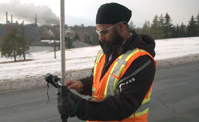
Geomatics technologists use various types of surveying equipment. This includes total stations (electronic distance-measuring instruments), global navigation satellite systems (GNSS), or a rod and level. They also use various software applications, such as ArcGIS, AutoCAD, and Google Earth.

Working Conditions
Updated Apr 11, 2022
  • Strength Required Lift up to 20 kg

Geomatics technologists work alone and in teams. They may work with:

  • Land surveyors
  • Engineers
  • Other technologists
  • Many other types of tradespeople on construction projects

They work indoors creating and studying data. They work outdoors conducting surveys in all weather conditions. They may need to travel extensively, sometimes to remote areas.

Interests & Abilities

In Alberta, this occupation is part of 1 or more 2006 National Occupational Classification (NOC) groups. If there are multiple related NOC groups, select a NOC heading to learn about each one.

Survey Technologists

2006 NOC: 2254.1

Interest Codes

Interest Codes for This NOC Group
OBJECTIVE

Interest in precision working to operate instruments and computer equipment to measure distance, angles, elevations and contours; to determine precise geographic locations using global positioning systems (GPS) equipment; and to prepare detailed drawings, charts and plans

INNOVATIVE

Interest in analyzing latitude, longitude and angles to plot features, contours and areas; and in assisting survey engineers and professional surveyors to develop methods and procedures for conducting field surveys

METHODICAL

Interest in supervising and co-ordinating field survey activities; and in recording measurements and other information obtained during field surveys

Your Interest Codes

To identify or change your interest codes, complete the Interests Exercise in CAREERinsite.

Reading Interest Codes
A Quick Guide

The interest code helps you figure out if you’d like to work in a particular occupation. 

It’s based on the Canadian Work Preference Inventory (CWPI), which measures 5 occupational interests: Directive, Innovative, Methodical, Objective, and Social.

Each set of 3 interest codes for this NOC group is listed in order of importance.

A code in capital letters means it’s a strong fit for the occupation.

A code in all lowercase letters means the fit is weaker.

Learn About Interests

Abilities

Typical ability expectations for this NOC group
Your abilities

To fill in or change the values for your abilities, complete the Abilities Exercise in CAREERinsite.

Mental Abilities

General Learning Ability

Verbal Ability

Numerical Ability

Visual Abilities

Spatial Perception

Form Perception

Clerical Perception

Physical Abilities

Motor Coordination

Finger Dexterity

Manual Dexterity

Understanding Abilities

A Quick Guide

You are born with abilities that help you process certain types of information and turn it into action. These abilities influence which skills you can learn more easily.

The abilities or aptitudes shown for this NOC group come from the General Aptitude Test Battery (GATB). The GATB measures 9 aptitudes. It groups them into 3 categories: mental, visual, and physical.

The abilities scores range from 1 to 5, with 5 being stronger.

Learn About Abilities

Traits & Skills
Updated Apr 11, 2022

Geomatics technologists need:

  • Math skills
  • The ability to think about geometric forms in a visual way
  • The ability to pick up important details in objects and drawings
  • Communication and observation skills
  • Physical fitness and endurance for field work
  • A willingness to work in remote, isolated areas

They should enjoy:

  • Working outdoors with equipment and instruments at precision tasks
  • Analyzing information and finding innovative solutions to problems
  • Taking a step-by-step approach to their work
  • Supervising and coordinating the work of others

In Alberta, this occupation is part of 1 or more 2016 National Occupational Classification (NOC) groups. If there are multiple related NOC groups, select a NOC heading to learn about each one.

Top 10 Skills Employers Are Looking For

Land survey technologists and technicians

2016 NOC: 2254

This chart shows which job skills are currently in highest demand for this occupational group. It was created using this occupation's 30 most recent Alberta job postings, collected between Mar 03, 2022 and May 09, 2024.

Review these skills to learn:

  • Whether or not this occupation matches your skill set
  • What training you may need to get these skills
  • What skills to highlight in your resumé, cover letter, and interview.
Survey Specialization: Land survey
Computer Systems: Valid driver's licence
Work Site Environment: Outdoors
Work Setting: Various locations
Walking
Construction Specialization: Team player
Attention to detail
Tasks: Participate in field surveys and operate survey instruments and devices
Survey Specialization: Topographic survey
Overtime required
Educational Requirements
Updated Apr 11, 2022
  • Minimum Education 2 years post-secondary

The recommended background for geomatics technologists is a 2-year diploma in geomatics engineering technology. It is possible but not common to learn on the job and take related courses part time.


Related Education

The following schools offer programs or courses that are related to this occupation but are not required to enter the field.

To expand or narrow your search for programs related to this occupation, visit Post-Secondary Programs.

Completing a program does not guarantee entrance into an occupation. Before enrolling in an education program, prospective students should look into various sources for education options and employment possibilities. For example, contact associations and employers in this field.

Certification Requirements
Updated Apr 11, 2022
  • Certification Provincially Regulated

The Alberta Society of Surveying and Mapping Technologies (ASSMT) offers 4 levels of certified survey technician and technologist (CST) certification:

  1. Technician
  2. Senior technician
  3. Technologist
  4. Senior technologist

A fifth level of certification, registered survey technologist, is under development.

Applicants are certified based on a combination of education and experience gained in the surveying and mapping industry. In general, the more related education an applicant has, the fewer the years of experience required for certification.

All certified member applications are reviewed by:

  1. The panel of examiners
  2. The certification board
  3. The ASSMT council for membership (final approval).

Additional certification options are available from other organizations.

Certain professional titles or duties within this occupation are protected by provincial legislation. Requirements vary if you use these titles or perform these duties.

The related legislation is shown below. If there are multiple related legislations, select a certification heading to learn about each one.

Certified Engineering Technologist

Certified engineering technologists (CET) use industry-recognized codes, standards, procedures, and practices to solve problems within their technological areas of expertise. Depending on their duties, they may need supervision by a Professional Engineer, Professional Geoscientist, or Professional Technologist (Engineering / Geoscience).

Legislation

Under Alberta’s Engineering and Geoscience Professions Act [pdf] and ASET Regulation [pdf], you must register with the Association of Science and Engineering Technology Professionals of Alberta (ASET) to use the protected title Certified Engineering Technologist (CET).

You do not have to register if you do not call yourself a Certified Engineering Technologist.

For information on what you need and other details, visit the certification profile Certified Engineering Technologist.

Professional Technologist (Engineering or Geoscience)

Professional Technologists (Engineering) and Professional Technologists (Geoscience) are currently unique to Alberta. They practice independently according to established methodologies and specifications in the fields of engineering and geoscience. They have the authority to sign off and stamp work within a prescribed scope of practice.

Legislation

Under Alberta’s Engineering and Geoscience Professions Act [pdf] and Professional Technologists Regulation [pdf], you must register with the Association of Science and Engineering Technology Professionals of Alberta (ASET) as a Professional Technologist (Engineering or Geoscience) to:

  • Practise engineering or geoscience within a prescribed scope of practice
  • Use the titles Professional Technologist (Engineering) or Professional Technologist (Geoscience)
  • Use the abbreviations P.Tech. (Eng.) or P.Tech. (Geo.)

For information on what you need and other details, visit the certification profile Professional Technologist (Engineering or Geoscience).

Employment & Advancement
Updated Apr 11, 2022

Geomatics technologists work for:

  • Engineering and legal survey firms
  • Aerial photographers
  • Mapping companies
  • Seismic services companies
  • Natural resource companies
  • Governments
  • Utility companies
  • Construction companies
  • Survey instrument suppliers

Geomatics technologists may be promoted to supervisor and be responsible for other technologists. They may also move into data processing, drafting, or project management. Technologists can become land surveyors if they pursue further education and training. Tto learn more, see the Land Surveyor occupational profile.

Industry Concentration

This section shows the industries where the majority of people in this occupation work. The data is based on the 2016 Census.

In Alberta, this occupation is part of 1 or more 2016 National Occupational Classification (NOC) groups.

In the 2254: Land survey technologists and technicians occupational group, 75.7% of people work in:

Employment Outlook

Employment outlook is influenced by a wide variety of factors including:

  • Time of year (for seasonal jobs)
  • Location in Alberta
  • Employment turnover (when people leave existing positions)
  • Occupational growth (when new positions are created)
  • Size of the occupation
  • Trends and events that affect overall employment, especially in the industry or industries from the previous list

In Alberta, the 2254: Land survey technologists and technicians occupational group is expected to have an above-average annual growth of 2.6% from 2021 to 2025. In addition to job openings created by employment turnover, 45 new positions are forecasted to be created within this occupational group each year.

Note
NOC groups often include several related occupations. Although there is labour market data for the larger NOC group, this occupation makes up only a part of that group. It means data for this occupation may be different than the data shown. For example, only some of the new positions to be created will be for this occupation. It also applies to other data for the NOC group such as number of people employed.

Source: 2021-2025 Alberta Regional Occupational Demand Outlook

Employment turnover is expected to increase as members of the baby boom generation retire over the next few years.

Related Alberta Job Postings
Wage & Salary
Updated Apr 11, 2022

In Alberta, this occupation is part of 1 or more 2016 National Occupational Classification (NOC) groups. If there are multiple related NOC groups, select a NOC heading to learn about each one.

Land survey technologists and technicians

2016 NOC: 2254
Average Wage
$32.26
Per Hour
Average Salary
$66,203.00
Per Year
Average Hours
39.9
Per Week
Average Months on Payroll
11.9
Survey Methodology Survey Analysis

Source
2021 Alberta Wage and Salary Survey

NOC 2254 Wage Profile

Unless otherwise noted, the data shown here is for all industries and all regions in Alberta.

All wage estimates are hourly except where otherwise indicated. Wages and salaries do not include overtime hours, tips, benefits, profit shares, bonuses (unrelated to production), and other forms of compensation.

To see the full survey data for this NOC group, visit the wage profile.

Other wage sources
To make an informed wage and salary decision, research other wage sources [pdf] to supplement this data.

B: Good Reliability
Data Reliability Code Definition

Good Reliability, represents a CV of between 6.01% and 15.00% and/or fewer than 30 survey observations and/or if survey observations represent less than 50% of all estimated employment for the occupation.


Hourly Wage

For full-time and part-time employees
  • Low
  • High
  • Average
  • Median
Starting
Overall
Top

Hourly Wage

For full-time and part-time employees
Wages* Low (5th percentile) High (95th percentile) Average Median
Starting $18.00 $34.94 $25.03 $25.59
Overall $19.50 $42.44 $32.26 $32.85
Top $22.00 $59.05 $39.16 $41.87

Swipe left and right to view all data. Scroll left and right to view all data.

* All wage estimates are hourly except where otherwise indicated. Wages and salaries do not include overtime hours, tips, benefits, profit shares, bonuses (unrelated to production) and other forms of compensation.

Pay brackets for hourly wages

  • Starting pay: average pay offered for entry-level positions
  • Overall pay: average pay across all employees in this occupation
  • Top pay: average pay offered to top-paid employees

Industry Information

ALL INDUSTRIES
Professional, Scientific & Technical Services
Public Administration

Skills Shortage

Employers that Recruited in the Last 2 Years
46%
46%)
Recruiting Employers that Experienced Hiring Difficulties
42%
42%
Employers with Unfilled Vacancies of over 4 Months
6%
6%
Vacancy Rate
2%
Related Post-Secondary Field of Study
  • Engineering and Science Technologies
Other Sources of Information
Updated Apr 11, 2022

Alberta Society of Surveying and Mapping Technologies (ASSMT) website: assmt.ca

Association of Science and Engineering Technology Professionals of Alberta (ASET) website: www.aset.ab.ca

Get information and referrals about career, education, and employment options from Alberta Supports.

Updated Mar 31, 2022. The information contained in this profile is current as of the dates shown. Salary, employment outlook, and educational program information may change without notice. It is advised that you confirm this information before making any career decisions.

Was this page useful?